")
Posted on June 13, 2018
| Back to Showreel
What Is It Like Down There
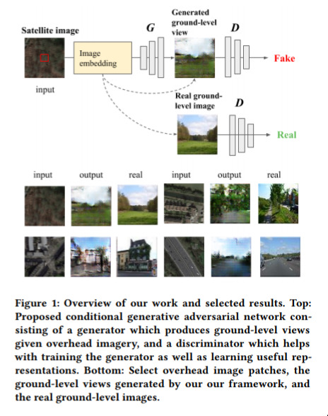
This is already a classic of the generative genre. They take a satellite photo, and then use GANs to work out what that particular region woud look like if viewed from the ground.
It’s amusing to me because it’s moderately well-posed; i.e. there is definitely the data present to make some kind of guess, but getting to the ground truth is kind of “obviously” impossible.
Even under such contraints, they do pretty well! And, as we most of this generative work, this is something that will only get better.
